Metadata
Showing
2
of
2
records
(filtered)
Applied filters:
Country: Albania
×
Topic Category: planningCadastre
×
Keywords: Lin
×
Clear all filters
| Preview |
Title
|
Abstract
|
Country
|
INSPIRE Theme
|
Publication Date
|
Responsible Party
|
Topic Categories
|
Keywords
|
Access Constraints
|
Actions |
|---|---|---|---|---|---|---|---|---|---|---|
|
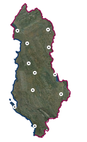
State Magnetometric Network (Epoka 2017.5) | The National Magnetometric Network is a network of 11 repeatable magnetic stations, distributed as uniformly as possible in the national … | Albania | Oct. 13, 2020 | State Authority for Geospatial Information | copyright |
|
|||
|
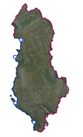
State Tidal Network | The State Tide Network consists of four sea level measuring stations along the coastline of the Republic of Albania, which … | Albania | Oct. 13, 2020 | State Authority for Geospatial Information | copyright |
|
Showing
2
of
2
records