Metadata
Showing
2
of
2
records
(filtered)
| Preview |
Title
|
Abstract
|
Country
|
INSPIRE Theme
|
Publication Date
|
Responsible Party
|
Topic Categories
|
Keywords
|
Access Constraints
|
Actions |
|---|---|---|---|---|---|---|---|---|---|---|
|
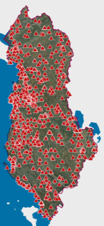
AKEP, Antenna Base | Electronic communications facilities used by electronic communications companies and serve to place active transmission equipment. The data are in accordance … | Albania | Sept. 14, 2023 | Electronic and Postal Communications Authority - AKEP | copyright |
|
|||
|
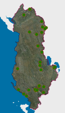
Environmental Monitoring Infrastructure, Threatened Tree Species Monitoring Network 2020 | Monitoring of tree species that are under threat of extinction, for the year 2020. The data are in accordance with … | Albania | Feb. 14, 2023 | National Environmental Agency | copyright |
|
Showing
2
of
2
records