Metadata
Showing
1
of
1
records
(filtered)
Applied filters:
Country: Bosnia and Herzegovina
×
Topic Category: Land Use / Planning Units
×
Keywords: Alipašin most I
×
Clear all filters
| Preview |
Title
|
Abstract
|
Country
|
Resource Type
|
Publication Date
|
Responsible Party
|
Topic Categories
|
Keywords
|
Access Constraints
|
Actions |
|---|---|---|---|---|---|---|---|---|---|---|
|
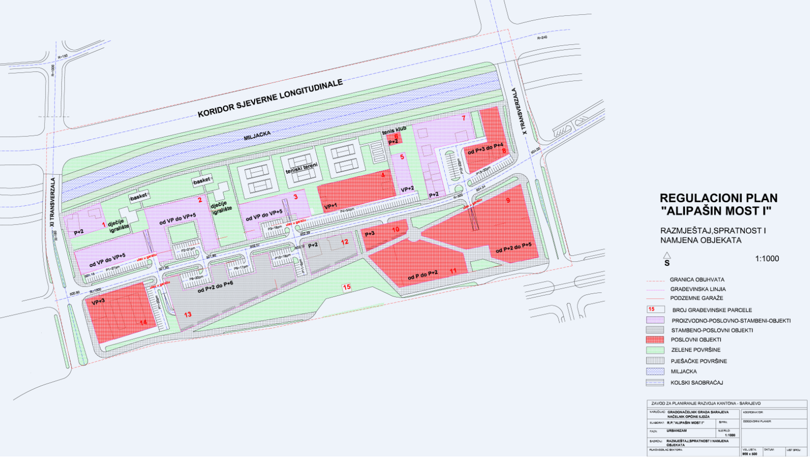
Regulatory plan "Alipašin most I" | The area covered by the Regulatory Plan "Alipašin most I" is located between the X and XI transversals, the Miljacka … | Bosnia and Herzegovina | Dataset | May 8, 2001 | Sarajevo Canton Development Planning Institute | other Restrictions |
|
Showing
1
of
1
records