Metadata
Showing
2
of
2
records
(filtered)
| Preview |
Title
|
Abstract
|
Country
|
INSPIRE Theme
|
Publication Date
|
Responsible Party
|
Topic Categories
|
Keywords
|
Access Constraints
|
Actions |
|---|---|---|---|---|---|---|---|---|---|---|
|
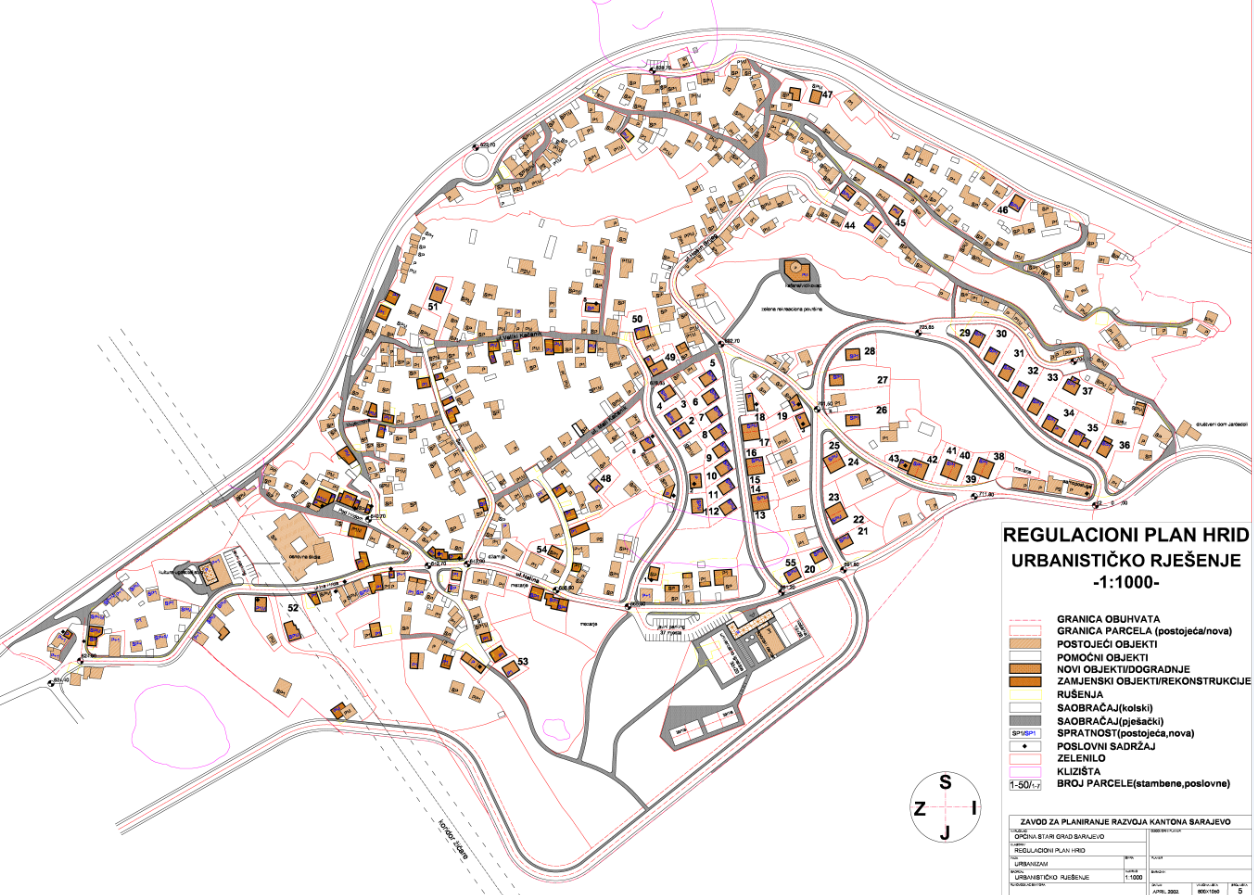
Regulatory plan "Hrid" | The area of 26.80 ha, included within the Plan's boundary, occupies the northern slopes of Trebević, the area above the … | Bosnia and Herzegovina | July 25, 2002 | Sarajevo Canton Development Planning Institute | other Restrictions |
|
|||
|
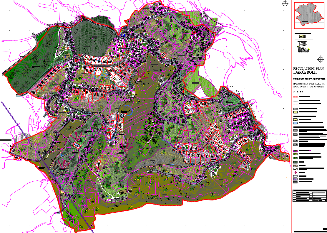
Regulatory plan "Jarčedoli" | The detailed planning document, the "Jarčedoli" regulatory plan, is based on the adopted land use policy, development strategies and programs, … | Bosnia and Herzegovina | Nov. 24, 2015 | Sarajevo Canton Development Planning Institute | other Restrictions |
|
Showing
2
of
2
records