Metadata
Showing
3
of
3
records
(filtered)
Applied filters:
Country: Bosnia and Herzegovina
×
Responsible Party: Sarajevo Canton Development Planning Institute
×
Keywords: database
×
Clear all filters
| Preview |
Title
|
Abstract
|
Country
|
INSPIRE Theme
|
Publication Date
|
Responsible Party
|
Topic Categories
|
Keywords
|
Access Constraints
|
Actions |
|---|---|---|---|---|---|---|---|---|---|---|
|
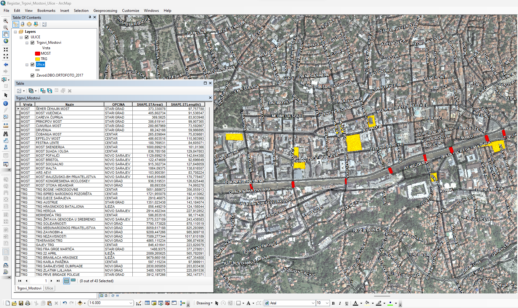
Database of streets, squares and bridges | The Register of Streets, Squares and Bridges of the Sarajevo Canton contains the names of streets, squares and bridges classified … | Bosnia and Herzegovina | Jan. 1, 2015 | Sarajevo Canton Development Planning Institute | other Restrictions |
|
|||
|
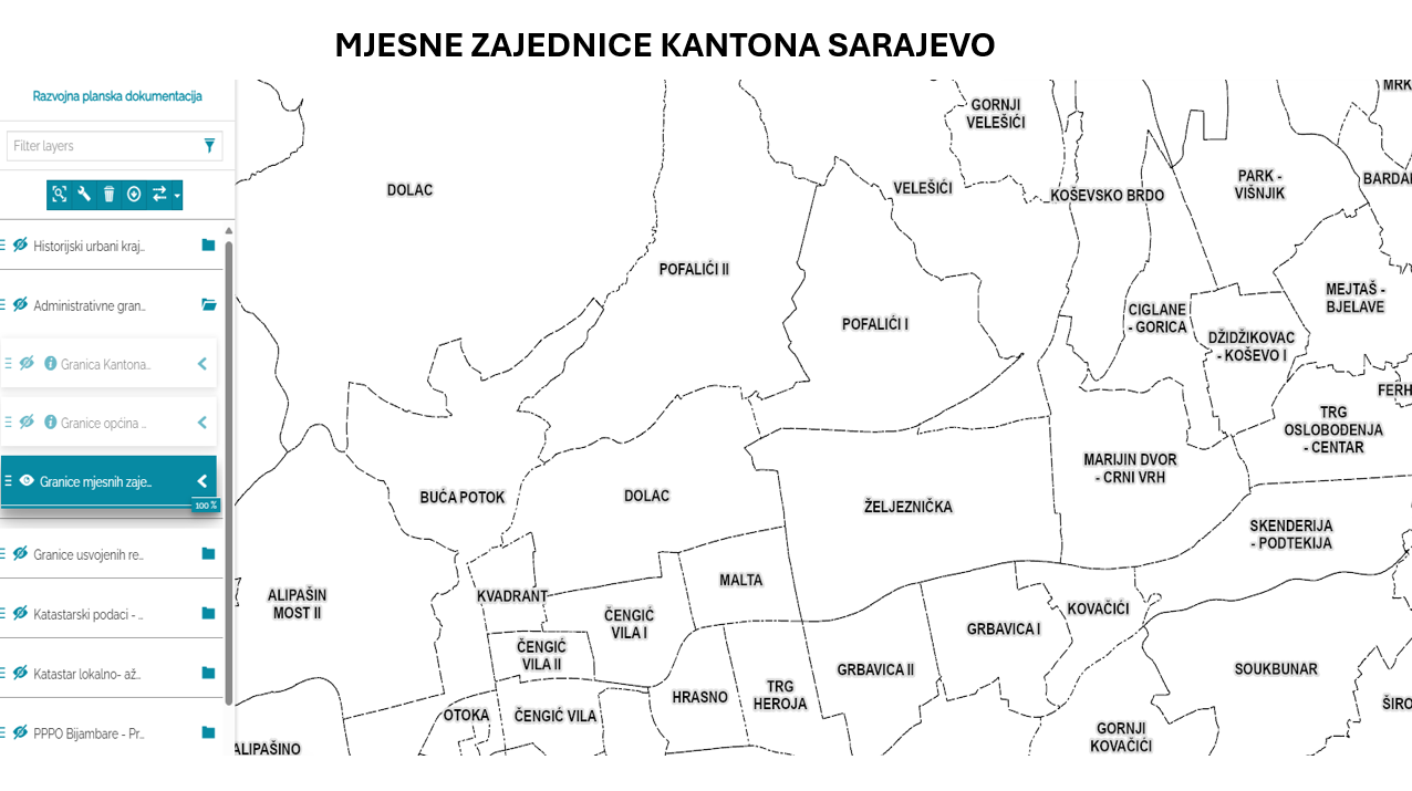
Database of the boundaries of local communities of the Sarajevo Canton | Within the local self-government system in the Sarajevo Canton, the local community is a mandatory and closest form of organizing … | Bosnia and Herzegovina | Jan. 1, 2003 | Sarajevo Canton Development Planning Institute | other Restrictions |
|
|||

|
Sarajevo Canton Urban Planning Approval Database | An urban planning permit is an administrative act that confirms that the planned construction is in compliance with the applicable … | Bosnia and Herzegovina | Jan. 1, 2007 | Sarajevo Canton Development Planning Institute | other Restrictions |
|
Showing
3
of
3
records