Metadata
Showing
3
of
3
records
(filtered)
| Preview |
Title
|
Abstract
|
Country
|
INSPIRE Theme
|
Publication Date
|
Responsible Party
|
Topic Categories
|
Keywords
|
Access Constraints
|
Actions |
|---|---|---|---|---|---|---|---|---|---|---|

|
District heating network | The utility cadastre is a special technical record in which data on all underground and above-ground utility installations are collected, … | Bosnia and Herzegovina | Jan. 1, 1982 | Sarajevo Canton Construction Institute | restricted |
|
|||
|
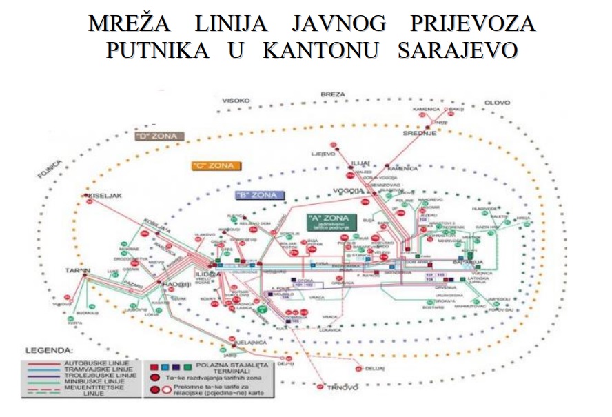
Network of public passenger transport lines in Sarajevo Canton | The public transport network is a set of all lines that in the territory of the Sarajevo Canton constitute subgroups … | Bosnia and Herzegovina | Jan. 1, 2014 | Ministry of Transport of Sarajevo Canton | other Restrictions |
|
|||

|
OpenStreetMap Transport Points for Bosnia and Herzegovina | Transport facilities points from OpenStreetMap for Bosnia and Herzegovina | Bosnia and Herzegovina | Oct. 19, 2024 | OpenStreetMap Contributors | Open Database License |
|
Showing
3
of
3
records