Metadata
Showing
3
of
3
records
(filtered)
| Preview |
Title
|
Abstract
|
Country
|
INSPIRE Theme
|
Publication Date
|
Responsible Party
|
Topic Categories
|
Keywords
|
Access Constraints
|
Actions |
|---|---|---|---|---|---|---|---|---|---|---|
|
Management plan for the recycling yard at RCUO "Smiljevići" | A recycling yard has been opened within the Regional Waste Management Center Smiljevići, intended for the sorting and temporary storage … | Bosnia and Herzegovina | April 1, 2018 | KJKP "RAD" doo Sarajevo | copyright |
|
|||

|
Technical guidelines for the establishment of recycling yards in Sarajevo Canton | Recycling yards are a link between citizens, authorized collectors and authorized waste processors and/or the regional waste management center. Separately … | Bosnia and Herzegovina | March 1, 2024 | KJKP "RAD" doo Sarajevo | copyright |
|
|||
|
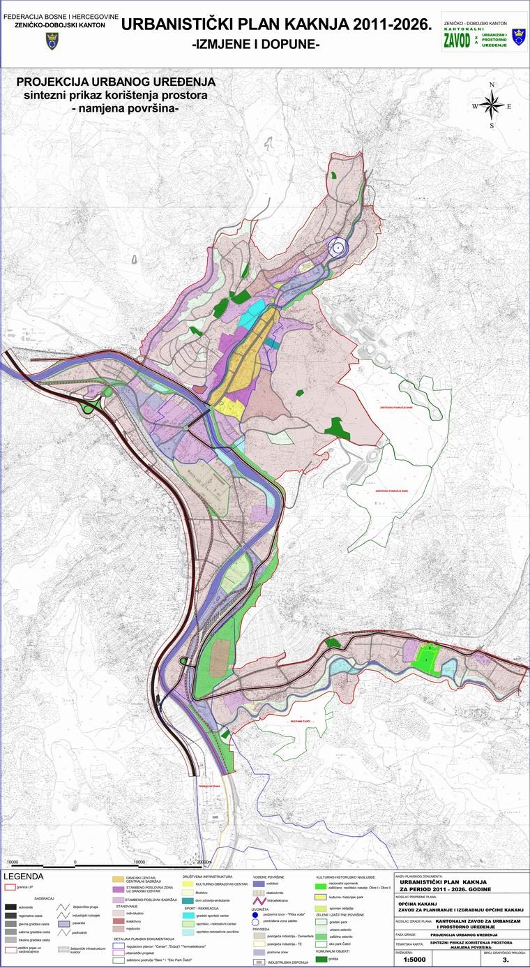
Urban plan of Kakanj 2011-2026. | The urban plan is a binding planning document established by the Decision on the Implementation of the Spatial Plan of … | Bosnia and Herzegovina | Aug. 15, 2011 | Institute for Urban Planning and Spatial Development of Zenica-Doboj Canton | other Restrictions |
|
Showing
3
of
3
records