Metadata
Showing
1
of
1
records
(filtered)
Applied filters:
Keywords: Units
×
Clear all filters
| Preview |
Title
|
Abstract
|
Country
|
INSPIRE Theme
|
Publication Date
|
Responsible Party
|
Topic Categories
|
Keywords
|
Access Constraints
|
Actions |
|---|---|---|---|---|---|---|---|---|---|---|
|
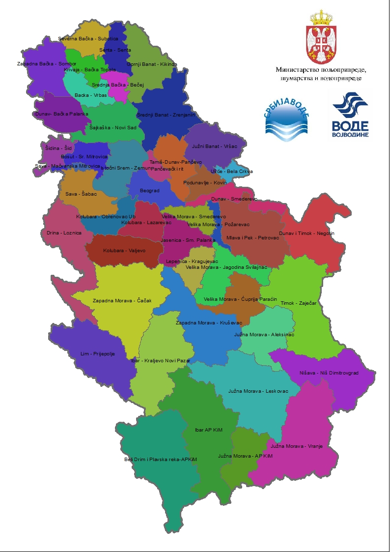
Water units | Water units are the basic territorial units for carrying out operational work in water management, based on established criteria, namely: … | Serbia | None | PWMC Srbijavode | copyright |
|
Showing
1
of
1
records