Metadata
Showing
1
of
1
records
(filtered)
Applied filters:
Responsible Party: Republic Geodetic Authority
×
Keywords: network
×
Clear all filters
| Preview |
Title
|
Abstract
|
Country
|
INSPIRE Theme
|
Publication Date
|
Responsible Party
|
Topic Categories
|
Keywords
|
Access Constraints
|
Actions |
|---|---|---|---|---|---|---|---|---|---|---|
|
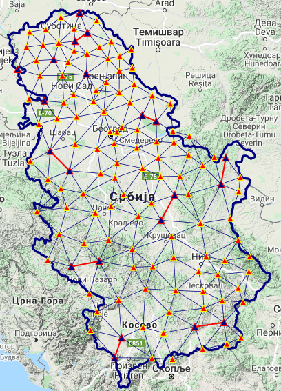
National trigonometric network | The national trigonometric network consists of a set of permanently stabilized reference points which are spatially classified into two main … | Serbia | June 1, 2008 | Republic Geodetic Authority | otherRestrictions |
|
Showing
1
of
1
records